Waw an Nemus - Volcanic crater at Sahara desert - Libya.

Waw an Namus - Volcanic crater - Libya.
“Waw an Namus” you may astonish what is it. It is an extinct volcanic crater, which means a dead volcanic hole. It is one of the remote locations in Libya.  Indeed it is located almost at the geographic center of the Sahara desert. Further this is often referred to as the eighth natural wonder of the world.

This is about four kilometers in width, with one hundred meters deep cone of the volcano which is known as ‘Caldere’ which has yellow Sulphur deposits around its one hundred and fifty meters width crater. Further this volcano is surrounded by an area of black deposit of ash which is spread 10 to 20 kilometers in width. This is the main reason for its appearance as the ‘Dark spot’ in the Google Earth.

More over on the floor of the ‘Caldera’ you can see three small salty, coloured lakes which are infested with mosquitoes and be as the especial reason for the name of the volcano ‘Waw an Namus’. Because ‘Waw an Namus’ means ‘Oasis of Mosquitoes’ or ‘The Crater of the Mosquitoes’

Let us see how we all happened to get to know about this volcano. This volcano was first stated by ‘Karl Moritz Von Beurmann and Gerard Rohlfs who had never visited this site. A French Military Officer, Laurent Lapierre had the first opportunity to visit this in 1920 and reported this as an important watering point. About 1930 an Italian Geologist, Ardito Desio reached this site during his well known long camel journey through Sahara desert and published a geological description of this scenic volcano for the first time in 1935. After the Second World War, this volcano became a specific location of research for scientist and geologist.

Nowadays this is the main destination in the Sahara desert for the most number of tourists who visit the Deserts. As the oasis here are known as the ‘Oasis of Mosquitoes’ camping nearby this site requires mosquito nets or repellents. Really those three small lakes in the area are the reason of attraction and urge for many travellers to visit here.

Waw an Nemus - Sahara Desert - Libya.
3 Oasis at the Waw an Nemus.
One of the Oasis at the Waw an Nemus - Google Map view.
Landscape of  an Oasis at the Waw an Nemus.

Akurala Beach - A natural beach like a swimming pool.

Akurala Beach - Southern Province, Sri Lanka
I can swear nobody can get an experience which you can gain in a man – made swimming pool in a sea which is a natural water resource. But, you all can get this fantastic real experience in Akurala beach in the Southern part of Sri Lanka which located on the route A2 along the Galle road, about 25 kilometers away from Galle town. You may wonder why I boast about a swimming pool, but  you cannot deny, it is the place where we get training for swimming without the fear of the force which is made by the moving ocean waves and enjoy hours of swimming to soothe our mind and have a good exercise.

As you all know Sri Lanka is a beautiful island in the Indian Ocean which is known as ‘The Pearl of the Indian Ocean’. So there is no doubt that it has plenty of golden sandy beaches. However, some beaches have their unique specialties and stand alone with their own pride. In this way ‘Akurala Beach’ has its own pride with its natural swimming pool like nature. It is spread about one kilometer area along the Galle road in the shape of an open mouth of a crocodile. Further you can get the pleasure of golden sandy seashore along the beach. Here and there you can feed your eyes with patches of purples flowers among the green leaves, which are called ‘Beach Morning Glory’.

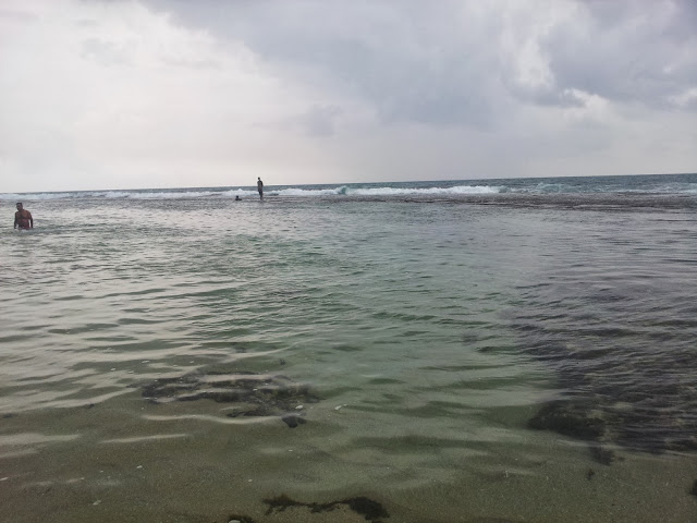
As you see in the map, from your left to right when you face the beach, there is a rock bench like a chain which is 3 to 6 feet width. From the sea shore it gradually goes inside the sea and separate the seashore from the big tidal waves. It spreads about 1 kilometers and the depth of the water area between the seashore and the rock bed also gradually goes deep from our foot level to 4 feet near the rock bed. The over flown sea water in this area again flows back to the sea via the open area of this natural pool. So you can feel the force near this opened area and it is better to keep small children away from this area.

It is nearly 90 kilometers from Colombo along the Galle road and takes two hours for travelling. If you go by the Southern expressway, it is 106 kilometers and it takes less than one and half hours. You can reach this place by train also which is nearly 100 meters away from the beach.

Here, if you are adults, you can rent out air filled lorry tubes for practicing swimming. There are air inflated animals and birds shaped toys for youngsters to get training for swimming and enjoying the pleasure of being in a pool. If you have enough courage you can walk along the rock bed on the side of the natural pool area, because the water level above the rock is nearly zero. But always it is sunk under water which is nearly 20 centimeters with the fresh tidal waves.

Google Map view of Akurala Beach and the nearest railway station.
A man on the rock bed - Akurala Beach, Sri Lanka.
People enjoying swimming in a rainy evening at the Akurala Beach, Sri Lanka.
Beach Morning Glory at the sea shore.

Adam's Bridge - A Chain of Sand Islands which connects India and Sri Lanka

Adam's Bridge
Adam’s Bridge is a chain of limestone which connects India and Sri Lanka at specific places. Indeed this is a string of sand islands. The other names of it are Rama's Bridge or Rama Setu. 

This bridge is 18 miles, it means 30 kilometers long and separates the southwest of Gulf of Mannar from the northeast of Palk Strait . Some of the sandbanks here are much dry. Especially the sea in the area is very shallow. It is being only 1 - 10 meters deep in places, which obstructs navigation.

When you see this in the map a small line which is connecting 2 countries i.e India and Srilanka is claimed to have been built by Rama's Army who are mentioned as Vanara, According to 'Ramayana' which is the Ancient Sanskrit Epic by Valmiki. When Lord Krishna’s incarnation 'Rama' faced the difficulty of crossing the Indian Ocean  to reach Lanka to set free his wife ‘Sita’ who was kidnapped by 'Ravana', this bridge was constructed by ‘Vanaras’ (Ape – Men) with the guidance of ‘Nala’.

But, the existence of Ramayana is questioned at present, whether it is a history or a fiction. If Ramayana can be proved as a history then this bridge will be declared as built by Men or Ape-Men, which claims it is man – made. However it is estimated according to images provided by the Nasa shuttle that this bridge is about 1,750,000 years ago. So there is no doubt this is a man – made bridge. Moreover it is believed when a cyclone broke the bridge apart and at present it cannot be crossed. 

A British Cartographer named this place as ‘Adam's Bridge’ in 1804 which gives reference to the Abrahamic myth. According that a man called ‘Adam’ used this bridge to reach Adam's Peak which is located in Sri-Lanka.

There are some more interesting and fascinating places near to this bridge. Such as Sri Ramanathaswamy Temple, Dhanush Kodi beach and Pamban Bridge in India and the Old Pier and Talaimannar light house in Sri Lanka.

Those who are in Sri Lanka can enjoy the landscape here, which is breathtaking on the white sands, shallow salty water ponds and sand grass with eye-catching colourful flowers. Further they can enjoy about 15 kilometers out to the sea which usually takes 3 hours including a stopover on one of the sand islands. There you can bath in the crystal clear water.

Location of Adam's Bridge - Connecting India and Sri Lanka

Adam's Bridge - Close view

Sand Islands in Adam's Bridge near Sri Lanka

The Bird Island - The Third Island in Adam's Bridge